|
|
Welcome
TEMPORARY PAGE - MTSRN - MONTANA STATE REFERENCE NETWORK
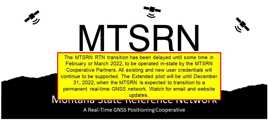
This is the temporary landing page for the MTSRN Pilot - a cooperative test network for a proposed Real-Time GNSS Cooperative in the state of Montana (working title: MTSRN - Montana State Reference Network). The name was temporarily made up for the pilot; the consortium that establishes a permanent RTN in the future can of course choose a different name. This proposed RTN, a regional cooperative of GPS/GNSS reference stations and data would enable cost-saving solutions for public and private sectors in the fields of surveying, mapping, science, precision agriculture, construction, and other high accuracy positioning technology needs. THIS PILOT WILL END DECEMBER 31, 2021.
LIVE MAP
PRINTABLE MAP
MTSRN STATIONS QUICK REFGERENCE SHEET.
Right-click to save: PDF
or
Excel
What is the MTSRN?
The MTSRN is operated as a cooperative pilot of partners that includes (but is not limited to), Tribal Nations, Missoula County, the Montana State Department of Transportation, agricultural equipment dealers, CORS of the National Geodetic Survey, scientific stations of the Earthscope Plate Boundary Observatory (PBO, operated by Unavco), and private entities who maintain, operate, or otherwise contribute to the operation of this pilot statewide array of over 30 GNSS reference stations. These GPS/GNSS stations provide raw GNSS observation data for both development of real-time corrections and logging of static files for high precision positioning. Static data is free to the public, with real-time services available for authorized partners in the pilot, or parties interested in possibly joining the cooperative
How the MTSRN Pilot Works
The MTSRN is a pilot, a test RTN set up to operate during the first half of 2019. It is a network of 30+ reference stations feeding raw observation data to the Washington State Reference Network (WSRN), the cooperatrive RTN in WA state that is hosting the pilot under an interstate cooperation agreement. The raw GNSS observations are processed on WSRN servers to create static files for download, and real-time corrections in standard formats. These are delivered by an 'NTRIP Caster' data portal (a cloud servicee). Thbis cloud service that can allow thousands of users to request correction streams from a network through a single portal. This service is being made avaiilable to interested GPS/GNSS users for the period of the pilot. This service is non-proprietary. Your gear (unless very oold) will be useable on the MTSRN: lmost without exception, manufactuers of high precision GNSS field equipment (built in the past 10-15 years) support the use of standard RTN correction streams and static files. Next steps: A committee of partners in Montana is working on funding and establishing in-state servers and operations so that Montana will be able to run its own RTN in the near future.
Real-Time Networks (RTN) - a Geospatial Amenity
There are over 400 Real-Time Networks (RTN) like the WSRN worldwide, some covering entire countries. Utilization is spreading beyond surveying and mapping to utilities, emergency response, agriculture, forestry, public safety, transportation, machine control for construction, environmental, and scientific research. Cost savings can be substantial. High accuracies are available, in real-time. By following proper procedures, users can observe locations (to centimeters) in seconds. Users are encouraged to take multiple measurements to ensure repeatable results.
Using the MTSRN Pilot - Post-Processing Users
If you are a GPS/GNSS post-processing user, you can download static files from any of the stations in the pilot by choosing the 'Reference Data Shop'. You will need to choose 'Login' on the left side of this page, and then log in as a 'Guest'; put in 'guest' (all lowercase) in each box for 'Organization', 'User name', and 'Password'. Then choose 'Reference Data Shop' on the left side of the page. Follow the prompts to make custom data downloads for single, or groups of stations. YTou can choose different time periods, intervals, and data formats (Rinex, DAT, etc). When you make an order, take note of the order number. Depending on the size of the order, it could take as long as 30 minutes to process. You can always leave the page and log in laterto look for your order number. Note that this is not an automated post-processing service (like NGS OPUS), but a future MTSRN could have that option if implemented. The Reference Data Shop is simply a convenient way to make custom static file orders.
Using the MTSRN Pilot - Real-Time Users - Single Base
There are multiple options for using 'real-time corrections' from the MTSRN pilot. If you prefer, you can obtain singe base RTK corrections for an individual station (e.g. 'BKFB' in Browning). If you look on the printable map
or the live sensor map
you can see the individual station 4-character names. On the live sensor map you can click on the green dots and see additonal info. It will first show station health, and if you click the 'Info' tab at the top you can see current station coordinates, ellipsoid height (in meters), and sensor type. When you look at the NTRIP caster source table in your field rover data collector software you may see multiple entries for each station. These represent different correction 'flavors' you can choose from. If you see a 4-character station name with no suffix like 'BKFB', then it is outputting 'CMR+' (used by some older rovers). If you see a '3' suffix, like 'BKFB3' then it also has an RTCM3.1 output for GPS+Glonass if that station is tracking both (see map). RTCM3.1 is a common international standard output compatible with nearly every rover built in the past 10 years. The results between CMR+ and RTCM3.1 will not be different, just different flavors for different rovers. If you see an 'MSM' suffix, it means that the station has multiple (3+) constellations: GPS + Glonass + Galileo and Beidou; the 'MSM output is RTCM3.2-MSM, and if your rover supports multiple constellations you will be able to use this to add the newer satellites to your RTK solution. Remember that single base solutions degrade over distance from a base, and from day to day as ionospheric and tropospheric conditions change. You may be working fine at 30km from the base on one day and only 15km on another. Short range single base yeilds very good results, typically under 10km from the base and there should be no differences. This is a long and complex subject to cover so to keep this brief...Network RTK (NRTK, VRS etc) was developed (and has grown over the past 20+ years) to enable wider spacing of stations, and model out the iono and tropo. We we have added some NRTK/VRS test areas to the pilot (see the next section).
Using the MTSRN Pilot - Real-Time Users - Network Solutions
There are multiple options for using 'real-time corrections' from the MTSRN pilot with 'network corrections' in addition to the single-base options outlined above. If you look at the printable map
you will see some small clusters of stations linked together, like in the Fort Peck and Blackfeet areas. These are VRS 'subnets'. For instance, the NWMTVRSRTCM3 mountpoint is the VRS solution you can use in that subnet in the Blackfeet area. Eventually, when more stations are connected, the six subnet areas on the map (NE, NW, SC, NC, NE and SE) will have more stations in the respective VRS solutions. In the interim, if you are working inside an area of linked stations you can use a network solution (e.g. NWMTVRSRTCM3), but if outside of those areas you should stick to single base solutions. When an entire state or subnet is covered with linked stations, many users only need to choose one mountpoint for all of their work. During this pilot there may only be a few areas of network solution; it might take a while (and lots of partners) to build out the whole state... stay tuned... The naming convention for the VRS subnets is the area of the state (e.g. MWMT) plus the solution type (e.g. VRS) plus the correction format (e.g. RTCM3). So 'NWMTVRSRTCM3' is a VRS solution, output in RTCM3.1 with GPS+Glonass (if your rover only does GPS-only that will also work). If you see a suffix of 'CMR' that is CMR+, and if you see 'MSM' then that is multiple constellations. Network RTK has some advantages over single-base in that it can work further from a base, it and can model-out changes in iono and tropo from day to day over a broad area; it works as if the base is right at your location with a near-zero baseline length. Again, there is a lot more to cover than we have room for here.
Geodetic Reference Framework - NAD83-2011 Epoch 2010.00
The geodetic policy of the MTSRN is to constrain all MTSRN stations to the National Spatial Reference System (NSRS) of the National Geodetic Survey (NGS). Some of the MTSRN stations are NGS CORS, and the rest are constrained to NGS CORS through a rigorous network adjustment. Note that many of the stations with 'P[number]' naming convention (e.g. Earthscope Plate Boundary Observatory, or 'PBO' stations like P047 and P722) are already NGS CORS, and many of the MDT stations (most areprefixed with 'MT') have been submitted to the NGS for inclusion as NGS CORS and have just been accepted. All non-CORS stations have been rigorously constrained to existing CORS.
All ellipsoid heights shown on this website are in meters unless otherwise stated. If you use corrections from the MTSRN (or almost any RTN) the default values derived on your rover would be ellipsoid, unless you specify the application of a Geoid-difference model in your software. In that case you would get orthometric elevations. The geoid application does NOT happen on the RTN side. The same goes for 'state plane coordinates'. The MTSRN does not(nor any RTN) broadcast 'state plane coordinate' references; those are derived/projected in your data collector or office software. Consult your rover vendor for settings specifics - the MTSRN does NOT support your hardware and software.
MTSRN Stations Quick Refrence Sheet.
Right-click to save: PDF
or
Excel
MTSRN Stations Sitelogs
: Directory
MTSRN Stations Reference Files.
Right-click to save: KML
or
CSV
MTSRN Partnerships
The MTSRN is just a pilot at this time, facilitated by an informal committee that includes the MDT, Tribal Nations, counties, schools, agricultural interests, etc. The idea behind this pilot is to demonbstrate the viability of an RTN for Montana, and to help the interested parties find more partners, and the backing needed to establish a permanent RTN in MT. If you would like to find out more about the work of this committee, or have your organization or comnpany join in and help this initiative move forward, contact Wally - see contact info below:
Montana Pilot Coordinator Contact:
- wally@mtsrn.org
Like to host, or help find a site for a new reference station?
If you see a hole in the current staus map of Montana and have a potential reference station site in mind (even if only temporarily to help with the MTSRN pilot) please contact us. If you have a stable place to mount an antenna (bedrock or non-alluivial stable ground on which to constuct a pillar or drill brace mount, or a solid, preferably single-story building, or other solid structure to mount an antenna, contact us. It could be your business location, local school, or other facility; as long as there is reliable power (120V 5A is sufficient) and some means to get the data to the internet. There are lots of options that do not require firewall holes, like your own Wifi router. The science partners of the WSRN have 20+ geodetic grade GPS+GLN capable receivers and choke ring antennas that can be loaned to the MTSRN to build out the network. Contact below.
Site Development Inquiries:
host_a_station@mtsrn.org
Like to try out the MTSRN?
Pilot Login Requests:
login_requests@mtsrn.org
NO WARRANTIES; LIMITATION OF LIABILITY
Use of MTSRN pilot services and any WSRN services, applications and features of this website, or any information contained on this website or through any links provided on this website is at the user's sole risk. The WSRN, WSRN partners, and Seattle Public Utilities provides WSRN/MTSRN Services on an 'as is' basis. Neither WSRN members, nor Seattle Public Utilities, its officers, employees, vendors, or third-party service providers (collectively or individually) makes any express or implied representation or warranty of any kind with respect to WSRN Services. By way of example and not of limitation, there is no representation or warranty (a) that WSRN Services will be uninterrupted or error-free, (b) that the results obtained from using WSRN Services will be accurate, reliable, complete or current, or (c) of merchantability or fitness for a particular purpose. WSRN Services and information related thereto are subject to change without prior notice.
Neither Seattle Public Utilities nor the subscriber, or WSRN members, is liable for any damages arising out of or in connection with MTSRN Pilot and WSRN Services, including without limitation mistakes, omissions, interruptions, deletion of files, errors, defects, viruses, delays in operation or transmission, or failures of the Continuously Operating Reference Stations (CORS). This is a comprehensive limitation of liability that applies to all damages of any kind, including compensatory, direct, indirect or consequential damages, loss of data, income or profit, loss of or damage to property and claims of third parties.
Login
|
|